21 Jun 2007
Here’s a fun Google nugget. This query:
http://www.google.ca/search?q=foss4g
Returns FOSS4G 2007 as the top result (yay!) when I execute it while logged into my Google account, but as the second result when I execute it while logged off.
20 Jun 2007
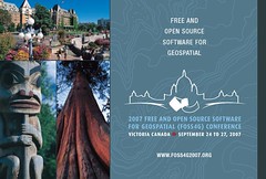
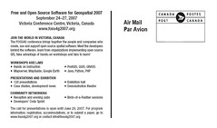
Two weeks ago, we sent out a physical postcard invitation to a list of about 10,000 potential FOSS4G attendees in the local region (BC, ALTA, WA, OR, CA) and GIS hotspots (VA, CO).
On Sunday, I sent out a mass email to about 1,000 addresses culled from my personal mail box, web searches, and magazine mailing list purchases.
Monday and Tuesday, the FOSS4G web site recorded the highest number of visitors to date, about a 50% increase over the medium term weekday average. It’s almost like advertising has a purpose. I feel my universe crumbling.
19 Jun 2007
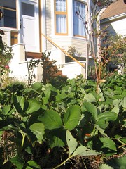
In the spirit of Sean’s tomato porn, I give to you, What Real Strawberries Are Like.
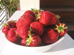
First, Real Strawberries come from very close by, preferably within a few feet of your table, like our front-yard patch:
Second, you pick Real Strawberries yourself, off the bush, and when you do, they look like this:
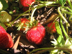
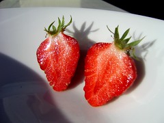
Third, a Real Strawberry is a perfect red color, and is perfectly clean right off the bush. You don’t wash Real Strawberries, because they don’t have anything on them that needs washing:

Finally, Real Strawberries are red all the way through, because they are ripe on the bush:
If you are lucky, you can grow enough Real Strawberries to have a whole dessert from them, like I did tonight:
Oh, yeah, mmmmmm, Real Strawberries, you make life worth living.
18 Jun 2007
As Western hyper-consumerists go, I’m pretty light on the old carbon foot-print. No car, walk to work, living in a temperate climate not requiring the furnace to work too hard, new insulation and weatherstripping on the house. Having gotten so far, it is annoying to blast all my progress out of the water every time I have to take a business trip on a jet plane. It would be nice to keep the hair shirt in place, even while cruising at 30,000 feet. I would pay money to do so.
On the surface, it seems like purchasing carbon offsets is the solution made for me. Air Canada even lets me purchase them right online with my ticket.
The trouble is, it looks like carbon offsets are a crock. The goal of the offset is to make it as if my polluting trip never happened. So my trip dumps X tonnes of carbon into the atmosphere, to make it like it never happened, I either have to remove X (direct offset), or somehow get someone else who would otherwise release X tonnes to not do so (indirect offset).

The direct offset seems like the best bet, but there are practically no ways of removing substantial quantities of CO2 from the carbon cycle. Note that I did not say “atmosphere”, I said “carbon cycle”. The global warming problem is that we’ve been digging carbon out of the ground and adding it to the biosphere, which cycles carbon from air to ocean to plants and people via the carbon cycle. Planting trees, the most popular direct offset, which removes carbon from the atmosphere, still retains the carbon in the biosphere… it is not back underground, it is just in a tree. When the tree dies in a couple hundred years, back into the atmosphere the carbon will go. Perhaps someone will start a carbon offset program that involves clear cutting mature forests and sinking them into the deep ocean.
The indirect offsets suffer from the fact that while everyone wants a carbon market, no one has built one that actually limits carbon output yet. If I knew a credit I bought on a market was tied to a verifiable, and permanently capped, amount of carbon, I could offset by buying a credit, then flushing it down the toilet.
Pollution markets tend to be tied to big fixed industries with measurable outputs. A verifiable carbon market would be great for individuals but tough on the big polluters, because individuals could suck credits out of the system, and would probably do so even faster than the planned cap reductions. If they did, then inevitably politics would result as the big industries cried foul, the planned caps would be relaxed, and the purchased “offsets” would suddenly lose much of their offsetting value.

So, direct offsets are basically impossible, because no one is pumping carbon back into the crust, and indirect offsets are very subject to manipulation and impotence. For now I’m left with most of my carbon footprint in jet fuel.


